Interactive Map of Lombardy Italy for WordPress, created with Google Interactive Maps WordPress plugin with Zoom.
Interactive Map of Lombardy Italy for WordPress with Google Geochart (Mappa interattiva Lombardia Italia). This Google map of Lombardy province of Italy uses new “fixate” function of the plugin, which allows to zoom map to any position and fixate it. This function practically allows users to display zoomed map of any country’s region(s), or zoomed map of several neighbouring countries. You can check also Interactive Map of East Coast USA, Interactive map of America, Interactive Map of England, Interactive map of Île-de-France.
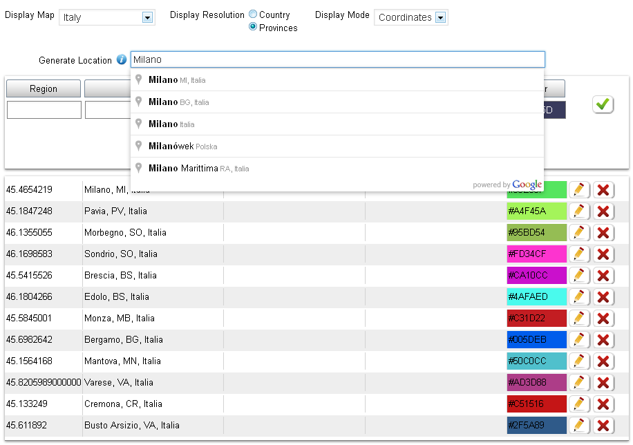
This demo map is created with Google Interactive Maps WordPress plugin, which let’s you create unlimited responsive interactive maps (Interactive World Maps, Europe Interactive Maps, Interactive US Maps, Africa Interactive Maps, Germany Interactive Maps, Interactive Maps of Canada and map of any other continent, country and US state).
Each map can be used multiple times in different posts and pages. Active data is shown in two ways: as fully colored Region, or Marker with colored bubble. Each active region can have: Tooltip on hover and an Action on click. Both tooltip and action values can have HTML text and images.
Plugin is based on Google GeoChart API, all necessary country and province data is included. Plugin enables to Zoom maps with mouse scroll and drag them. It creates SVG maps (No Flash).