• About
  • Maps Examples
    • World
    • USA
    • Europe
      • France
      • Greece
      • Germany
      • Ireland
      • Italy
      • Netherlands
      • Norway
      • Poland
      • Russia
      • Spain
      • Sweden
      • United Kingdom
    • Asia
      • China
      • India
      • Indonesia
      • Pakistan
      • Thailand
    • America
      • Central America
      • South America
      • Argentina
      • Brazil
      • Canada
      • Mexico
    • Africa
      • South Africa
    • Australia
    • Eurasia
    • Middle East
      • Israel
      • Turkey
  • Advanced Customization
  • Contact
  • Buy Now
Skip to content
  • About
  • Maps Examples
    • World
    • USA
    • Europe
      • France
      • Greece
      • Germany
      • Ireland
      • Italy
      • Netherlands
      • Norway
      • Poland
      • Russia
      • Spain
      • Sweden
      • United Kingdom
    • Asia
      • China
      • India
      • Indonesia
      • Pakistan
      • Thailand
    • America
      • Central America
      • South America
      • Argentina
      • Brazil
      • Canada
      • Mexico
    • Africa
      • South Africa
    • Australia
    • Eurasia
    • Middle East
      • Israel
      • Turkey
  • Advanced Customization
  • Contact
  • Buy Now
Home / About

About

Google Interactive Maps

WordPress Plugin

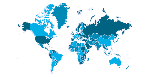
WordPress Plugin for creating interactive maps

Zoom Option, Predefined Data, SVG Maps (No Flash), Based on Google Geochart API

Google Interactive Maps plugin allows to create unlimited maps of

  • entire World (divided into countries, continents or subcontinents),
  • world Continent (divided into countries or subcontinents),
  • world Subcontinent (divided into countries),
  • a single Country (whole country or divided into provinces),
  • US State or Metropolitan areas
Active colored regions are shown in two ways: as fully colored Region, or Marker with colored bubble.Each active region can have Tooltip on hover and an Action on click. Both tooltip and action values can have HTML text and images.

For each map individually can be set its own

  • Width and Height,
  • Background color,
  • Border width and color,
  • Inactive region color,
  • Marker size,
  • Zoom possibility,
  • Action on click.
Plugin allows to use both shortcodes for posts, pages and widgets, and just insert the code into template. Plugin is based on Google GeoChart API, all necessary country and province data is included. Plugin enables to zoom maps with mouse scroll and drag them. Creates SVG maps (No Flash).

Categories

  • Advanced Customization
  • Africa
  • America
  • Argentina
  • Asia
  • Australia
  • Brazil
  • Canada
  • Central America
  • China
  • Eurasia
  • Europe
  • France
  • Germany
  • Greece
  • India
  • Indonesia
  • Ireland
  • Israel
  • Italy
  • Lithuania
  • Mexico
  • Middle East
  • Netherlands
  • Norway
  • Pakistan
  • Poland
  • Russia
  • South Africa
  • South America
  • Spain
  • Sweden
  • Thailand
  • Turkey
  • United Kingdom
  • USA
  • World

Tags

background color (2) background image (2) Contact Forms (1) content below (1) custom icons (1) custom logos (3) fixed zoom (5) hover color (3) iframe below (2) map replacement (1) maps overlay (2) no neighbours (2) popup (1) popup gallery (1) popup image (5) popup map (3) popup video (2) popup website (2) text labels (5) tooltip background color (1) tooltip border radius (1) tooltip image (3) tooltip text color (2) transparent background (2) transparent tooltip (1) US state (4)
Copyright © 2018. Created by Edarco. Powered by WordPress.